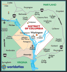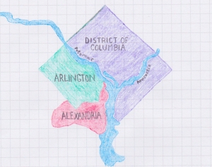
For this assignment, I selected a map of the District of Columbia from the World Atlas website. I liked how clean and simple this map looked. It has a contemporary, digital feel to it. I decided that this would serve as a nice model for the two maps I needed to create, one drawn freehand, the other rendered digitally. After printing the map out, I added a grid over it so that I could take my colored pencils and a piece of graphing paper and create a larger version of the same map (more or less) by hand.
The process of recreating the geometric shapes that make up the land masses on the map, slowly, grid by grid, was painstaking and a bit nerve-racking. I had to restart several times when I made careless errors. The basic principle of the exercise was easy enough to understand, however.

I think my hand-drawn map came out looking acceptable. Part of what I liked about the original map was how DC and the surrounding suburbs felt like they were floating on these two rivers that run beneath.
Looking at the two of them here now, I wish I had also added the major freeways, as they are like rivers unto themselves. And without the surrounding states of Maryland and Virginia labeled clearly, maybe it leans too heavily on the representation of DC as a floating city. I am, however, in general happy with the final product seen here.
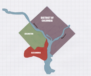
For the second map, I wanted to scan the freehand map and trace it digitally. I scanned the freehand map before I added the lettering so that it would be simpler for me to add digital lettering to the digital map. I find Adobe Illustrator to be very fun and easy to use. Tracing my map using the pen tool took only an hour or so (as compared to the four or five hours that the freehand map required).

My intention with the digital map was to use the freehand map as aesthetic inspiration and to generate with digital tools something that would approximate the look and feel of the freehand map. Needless to say, the digital map has a more accomplished look to it. I tried to keep it as simple as the freehand map and replicate the features of the freehand map as closely as I could with Adobe Illustrator. I will be interested in getting feedback on the quality of my work here on both these maps, and I will be curious to see what the rest of the class manages to come up with. I can only hope mine isn’t the most primitive.
My comments on April Kelley’s blog post: “Free Hand and Digital Map Project”
My comments on Michael Roth’s blog post: “Drawn and Digital Map”
I think your hand-drawn map turned out great! It looks very clean and and accurate. Your digital rendering of it is also impressive. I like that you focused on DC and used different colors than the original. I’m wishing I had taken on a smaller region now, as I’m still working on an 1856 map of Prussia…Not sure what I was thinking, with so many states with crazy borders. I hope to get it posted by this evening. Great job!
LikeLike